ClipperWatch 2007
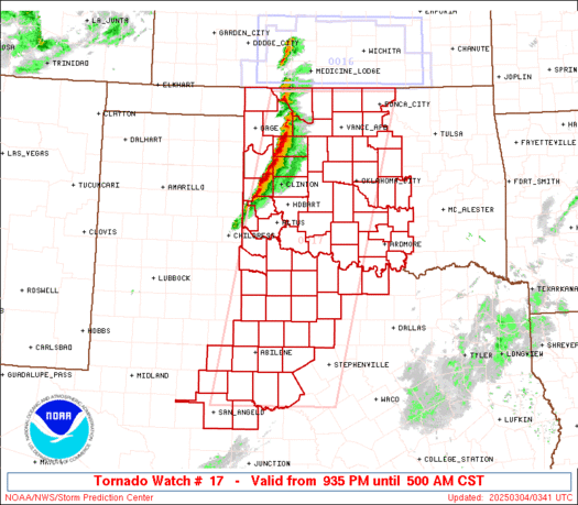
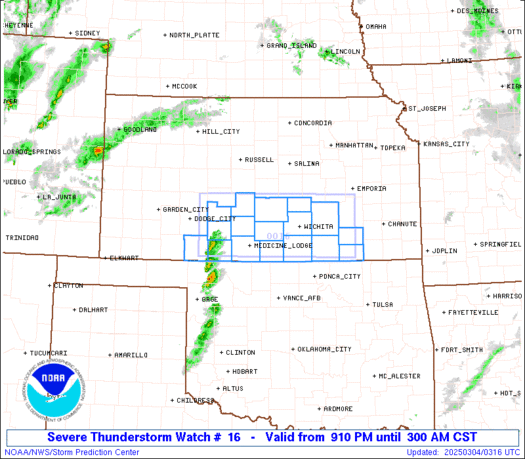
* If this was one of those big, hyped weather events, perhaps the title of this post would make a good promotional name. ClipperWatch 2007 is underway, as we are watching a weak clipper system moving through the southern and central Plains tonight. These systems are called "clippers" because they move at a rapid clip. They are also usually starved for moisture, and this particular clipper is no exception.
* This system could bring enough moisture for a few flakes of snow as far south as northern Mississippi and northern Alabama, with some light snow accumulation along and north of U.S. Highway 72. The better chance of accumulating snow will come across Tennessee, especially the Smokies.
* We can't rule out a flurry or sprinkle as far south as I-20, but that seems like a long shot. We will keep an eye on things.
* Off to Alabama for the weekend...Will post again Monday, be sure to check out Ashley McDonald at 6 and 10 Saturday night!
*
Labels: Forecast Discussion
Cold Friday Morning:
* Quick update this morning as we are close to that time of day we usually set the morning low. Looking at 6AM observations at the NWS sites, Meridian Key Field sits at 20 and in Northern Lauderdale County Meridian Naval Air Station is reporting 21. Northwest winds are blowing across the area this morning, which should keep temperatures a little warmer than expected but still areas could dip into the upper teens before sunrise.
* The record low this morning for Key Field is 16 which was set back in 1991.
* So far in 2007, the coldest morning we have seen was back on January 29th when the morning low reached 17 in Meridian.
* Winds will turn to the Southwest as we go into the night tonight and over the weekend which will lead to a nice warming tend with daytime highs back into the middle 50s and by early next week highs will get back into the 60s. Overnight lows will still be cold over the weekend, but next week lows will climb above freezing.
* Looks like showers and storms return to Eastern Mississippi and Western Alabama by middle of next week.
* Have yourself a great weekend!
February Made Me Shiver...
* I hope you'll join me in welcoming Chris Whited to the Weather BLOG. Chris, as I'm sure you've seen, is our new morning meteorologist and a fine addition to the team. He is a native of Oneonta, Alabama, and has a real passion for severe weather. If you'd like to drop him a note, feel free:
Chris.Whited@wtok.com* Tonight will be the coldest night of the young year 2007...Temperatures in most places will fall into the upper teens to lower 20's tonight. Exactly how cold it gets will depend on the wind.
When the wind goes completely calm, that allows the coldest air to settle to the Earth's surface, with no friction (a warming process). So, if the wind goes calm, expect middle teens. Should the wind continue all night, we'll see lower 20's. Either way, expect cold.
* It's worth noting that we may see a few snow flurries across northern parts of Mississippi and Alabama tonight. We don't anticipate any type of accumulation with these flurries, and almost all of them will stay to our north.
* Tomorrow will again be chilly, with highs in the middle 40's...Brrrrr. Be sure to bundle up.
* A warm-up is ahead by Monday and Tuesday, when we are seeing signs of a changing pattern. The trough (and cold air) we've seen over the eastern U.S. will begin to finally lift out, which will allow for warmer weather. The trade-off there is that we will likely deal with some thunderstorms along the way. Weather this time of year is never dull!
Labels: Forecast Discussion
Skywarn Class Tonight:
* Just a quick note that the National Weather Service in Jackson will be having a Skywarn Storm Spotter Class in Newton County tonight at the EMA in Decatur. The class starts at 6:30 PM.
* Also will take a minute to mention that next week is Severe Weather Awareness Week in Mississippi and Alabama. Here are some helpful links:
Mississippi:
http://www.srh.noaa.gov/jan/swaw/index.phpAlabama:
http://www.srh.noaa.gov/bmx/aware/swaw_2007/week_plans.php* See you all at 6:00 AM on Good Morning Meridian!
Brrrrrr....
* Meridian's temperature as of this writing has risen to a balmy 39 degrees. Make sure to bundle up if you are heading out for dinner or a walk around the block this evening, it will be quite chilly. A cold night is on tap, and readings area-wide will fall into the lower to middle 20's.
* Even colder weather is still ahead. Highs tomorrow will do well to even reach 40, despite a good supply of sunshine. The core of the cold will arrive tomorrow night, when temps plunge into the middle to upper teens...
* The cold weather will continue through the weekend. The models are suggesting highs Saturday and Sunday will reach the middle 50's, I think that is completely bogus. Given the upper-air pattern, I believe temperatures Saturday will again stay in the 40's. And, with a weak system passing through, we could see some light rain or light snow Saturday afternoon into Saturday evening. That's something we will monitor closely - it is worth noting that the Canadian computer model guidance shows an accumulating snow event for our area. For now, we will stick with showers or flurries, and continue to refine that forecast as we get a little closer to the weekend.
* Be sure to check out your latest forecast tonight at 5, 6, and 10 on Newscenter 11!
Labels: Forecast Discussion
Sumter/Greene Update
* We are watching the storm on the Sumter/Greene County line very closely...It is showing signs of rotation...There is no formal tornado warning, but if you live in Greene County, you might want to go ahead and go to a basement or lowest floor of your home for a while...
The worst of this storm will pass between Eutaw and Forkland along Hwy 43...
Labels: Severe Weather
SVR Sumter
* A Severe Thunderstorm Warning is in effect for Sumter County until 4:00 pm...The hail core within this storm will affect the State Hwy. 17 corridor from Geiger to Emelle, then move towards the town of Gainesville...
Hail is a good bet within this storm...Maybe larger than nickels in a few places.
Labels: Severe Weather
SVR Kemper
* NWS Jackson has issued a Severe Thunderstorm Warning for Kemper County until 3:45 PM...
* The primary threat with this storm is large hail. The hail core within this storm will pass just south of Dekalb and also just south of Scooba...
Labels: Severe Weather
Round Two
The Storm Prediction Center has issued a
Severe Thunderstorm watch for roughly the northern half of the area, along and north of the row of counties that US Highway 80 passes through...
In our area, it includes these counties:
MS
Scott
Newton
Lauderdale
Leake
Neshoba
Kemper
Winston
Noxubee
AL
Sumter
Greene
Marengo
Pickens
Hale
The primary threat within these storms will be large hail, due to the very cold air aloft.
We'll be watching things closely, and will keep you updated on the web and on television...
Labels: Severe Weather
515AM Update
Tornado Warnings continue for Kemper and Lauderdale County...I still maintain that the tornado threat with these storms is minimal. But, let's continue to play it safe and go to a basement or interior room on the lowest floor of your home if you live in eastern Lauderdale or southern Kemper County...The storms will pass to your east within the next 15-30 minutes or so...
The band of storms is weakening as it outruns its upper level support...But, I would anticipate a redevelopment of storms in Alabama.
Be sure to check out Chris Whited's forecast on Good Morning Meridian at 5,6, and 10.
Labels: Severe Weather
Tornado Warning: Lauderdale County
NWS has issued a Tornado Warning for Lauderdale County...
It's my opinion that the threat of strong gusty winds is far greater than the threat of a tornado. But, the end result is the same: if you live in Lauderdale County, you need to take cover in a basement or lowest floor of your home.
Labels: Severe Weather
Storms Imminent in Lauderdale
The leading edge of the bowing line of thunderstorms is approaching western Lauderdale County...Collinsville to Meehan will see the strong winds/rain first, followed by the remainder of the county...
Labels: Severe Weather
Bow Echo

Sure looks like a bow echo is developing...When these occur, damaging winds are more likely. This radar image shows the "bow" type signature, running from north to south across our area...Click on this thumbnail image for the full size version.
I'd be surprised if the NWS continues the Tornado Warning into Lauderdale County...The tornado threat has diminished, but the threat of strong, gusty winds has increased. We will keep you posted.
Labels: Severe Weather
Jasper County Note
Although there is no formal warning of any type for Jasper County, I believe there could be some very strong and perhaps damaging wind gusts in the northern part of Jasper County over the next 30 minutes or so...
Labels: Severe Weather
Tornado Warning: Newton County
NWS Jackson has issued a Tornado Warning for Newton County until 445AM...
This area of broad rotation will go over the city of Newton, so if you live there, go ahead and play it safe and take cover in a basement or interior room on the lowest floor of your home...
The NWS has informed us via IM that they are issuing this warning for the possibility of a "comma-head" tornado...These occur on the northern end of bowing line segments, are rare, and are usually pretty weak. It's my opinion that the greatest threat in Newton County right now is the threat of damaging wind gusts...
But, again, let's play it safe and go through your tornado safety plan if you live in central Newton County, especially the city of Newton.
Chris Whited will be providing updates on WTOK as soon as possible, we are having some staffing issues that we are working to provide.
Labels: Severe Weather
Troubling Report
Sounds like some bad damage down near New Orleans this morning. Be sure to scroll down for the latest info on the unfolding severe weather threat here...
PRELIMINARY LOCAL STORM REPORT
NATIONAL WEATHER SERVICE NEW ORLEANS LA
357 AM CST TUE FEB 13 2007

..TIME...   ...EVENT...      ...CITY LOCATION...     ...LAT.LON...
..DATE...   ....MAG....      ..COUNTY LOCATION..ST.. ...SOURCE....
          ..REMARKS..

0302 AM     TORNADO          WESTWEGO                29.90N 90.14W
02/13/2007                   JEFFERSON          LA   EMERGENCY MNGR

          HEAVY DAMAGES TO STRUCTURES REPORTED. MOBILE HOMES
          OVERTURNED. POSSIBLE INJURIES BUT UNKNOWN NUMBER.
Labels: Severe Weather
Tornado Warning: Scott and Smith Counties
NWS has issued a Tornado Warning for northern Smith and southern Scott County...
Looking at the velocity data, the area of rotation I believe this warning is for is located between Polkville and Burns, in northern Smith County...The radar signature is not overwhelming, but there are certainly signs of rotation within this thunderstorm.
This possible tornado will cross Hwy 35 near the county line, then move between Forest and Lake...
If you live in these areas, go ahead and take cover just to be safe.
Labels: Severe Weather
3:40 AM Update
* Here's our best thinking on the timing of the storms:
Hwy. 35 Corridor: Beginning Now, Lasting through Next Hour
This includes places like Carthage, Forest, Morton, and Raleigh
**SEVERE THUNDERSTORM WARNING NOW IN EFFECT FOR SCOTT AND SMITH COUNTIES**
Hwy. 15 Corridor: 4:15AM-5:30AM
Philadelphia, Noxapater, Newton, Bay Springs, etc.
Hwy. 45 Corridor: 5:30AM-7:00AM
Meridian, Clarkdale, Waynesboro, Scooba, Macon
The storms will enter into West Alabama sometime roughly around 630AM, affecting the Highway 17 corridor first, then getting over to Hwy. 43 by 8-9AM...Main threat is damaging winds, but a Tornado Watch remains in effect for the southern half of the area (scroll down for more info on that).
Labels: Severe Weather
Tornado Watch

There has been a Tornado Watch issued for roughly the southern half of our area. It includes these counties that we serve:
Smith
Jasper
Clarke
Wayne
Jones
In Alabama:
Clarke
Choctaw
Washington
The watch runs until 11AM, and includes cities such as Clarkdale, Bay Springs, Waynesboro, Laurel, Butler, Silas, and Grove Hill, to name a few. As of this writing, the only warnings in central Mississippi were
Severe T-Storm Warnings for Rankin and Simpson Counties.If you live in or close to the watch area, keep an eye on the weather this morning (which, if you are reading this blog, you are probably already doing just that)...
I note the dewpoint in Meridian has risen into the middle 50's...Still not a classic atmosphere for tornadoes, but it's enough moisture to cause problems.
Our newest team member, Chris Whited, is manning the fort this morning, I am monitoring things from home. Should conditions warrant, I will head to the weather office...
Labels: Severe Weather
Big Winter Storm...

With the impending threat of severe weather, I don't want us to take our eye off of the ball...But, I thought you might be interested to see the incredible coverage of Winter Storm Watches/Warnings/Advisories that extend from the Plains to New England because of this whopper-sized storm...
Click on the image for a full-sized graphic....
Labels: Winter Weather
Severe Weather Update...1:20 AM

We are still watching things closely for the possibility of severe weather this morning...A few individual cells have developed across parts of central Mississippi.
SPC has a Tornado Watch up for most of southeast Louisiana, and this will likely be extended into south Mississippi soon...
The dewpoint at Meridian's Key Field has risen to 48, which is still low, but the increase does show that the warm, moist air to our south is moving into the area.
We still believe there are two threats of severe weather, and the first threat is going to unfold over the next several hours. The main threat will be south of I-20, and will come in the form of large hail.
The low dewpoint values lead me to believe that these storms will be elevated in nature (that occurs when the thunderstorm is rooted on top of a relatively cool, stable layer of air near the Earth's surface). Elevated thunderstorms are usually producers of hail, and only rarely spawn tornadoes. However, in southern parts of our area, the moisture field is increasing quickly, and we could see some tornadoes...The best threat of that will again be south of I-20, close to US 84.
Another threat could unfold later today, as the cold core low swings overhead...And, the latest computer model guidance still suggests that we will see some VERY cold air later this week.
We'll be watching closely today...
Labels: Severe Weather
Tornado Watch: Louisiana

* The Storm Prediction Center has outlooked parts of southern and western Louisiana and southeast Texas for a threat of tornadoes this afternoon and into tonight. This is the same system that will affect us during the pre-dawn hours of tomorrow morning, so we must watch to see what happens in LA and TX with these storms.
* One thing that will help us with the first round of severe thunderstorms is that the sun will have been down for hours. That means lower surface heating, which is a prime ingredient in severe thunderstorms. By tomorrow afternoon, the sun will be back up, and the threat of severe weather will increase a bit.
* Scroll down for our previous (and still valid) discussion about exactly what we expect...
Labels: Severe Weather
Severe Weather Possible

There will be two periods of active weather as we move through the next 24 hours or so...An area of low pressure is taking shape to our northwest, with showers and thunderstorms now developing quickly over eastern Texas.
The front and the storms along it will move east through the night, bringing a threat of severe weather to our area. Let's talk details about the threat around here:
First ThreatTomorrow Morning approx. 2AM-9AMMain Threat: Large Hail, Gusty WindsThis first threat will bring a linear complex of thunderstorms, some of which could drop some large hail due to the cold air aloft in the atmosphere. Tornadoes are not out of the question as well, but hail should be the main threat in our area.
Second ThreatTomorrow Late Morning/Early Afternoon approx. 10AM-4PMMain Threat: Large HailAs the actual front approaches, very cold air aloft will move overhead. This will create an unstable atmosphere, which will probably kick off a second round of showers and thunderstorms. Again, the air aloft will be very cold, so the primary threat with this second round of storms will be large hail.
* We've had two tornado events in our area since late November, so let's all stay on our toes early tomorrow morning and into the afternoon. The best way to get weather warnings is a NOAA Weather Radio. If you don't have one, tonight would be a good time to stop by a consumer electronics store and pick one up. If you do choose to buy one, look for one with SAME technology. SAME allows you to program which county you live in, and receive only warnings for that county.
* AFTER the Severe Weather: Wow, is it about to turn cold. High temperatures Wednesday and Thursday will do well to reach 40, with a stiff northerly wind on Wednesday. Overnight lows will fall into the upper teens and lower 20's on Thursday and Friday mornings. A weak clipper-type system will move through by early Saturday, and yes, this has the potential to bring some light snow or flurries to parts of MS and AL. We'll be watching...
Labels: Forecast Discussion
Severe Weather?
With this next weather system we could be dealing with the possibility of some severe weather. Our main focus is for late Monday night as dewpoints rise back up into the 40's and 50's. Showers and thunderstorms should become more numerous during this period. For Tuesday, we could be dealing with more of an isolated event with storms that could become severe. At this point, the main threat will be large hail as the majority of these storms will be elevated. Keeping an eye on the weather over the next 48 hours......
Here's the latest
forcast discussion from Jackson....


