Another BBC Radio Interview...
* For you late night readers, be sure to listen in on a second interview with BBC Radio out of Lincolnshire, England...They had a tornado last night, so we'll talk about the hows and whys of tornadoes...Should be on within the next 30-45 minutes.
http://www.bbc.co.uk/radio/aod/lincolnshire.shtml
BBC Radio
* I'll be doing an interview with BBC Radio momentarily about tornadoes and the like...Should be a blast...Listen in:
http://www.bbc.co.uk/cambridgeshire/
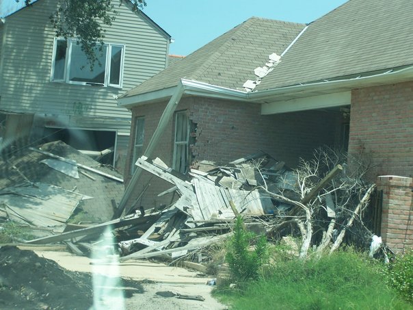
New Orleans: Still Recovering
* The one-year anniversary of Hurricane Katrina is coming up soon (August 29th). Our weekend meteorologist, Lauren Raymer, was recently in New Orleans and shared these poignant images. Be sure and scroll down to the final image...A real reminder of the immeasurable suffering in New Orleans and the Gulf coast.
* This house was lifted off its foundation and deposited intact on a nearby street:


/>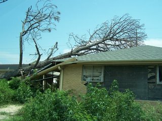
* A touching reminder of the vast human suffering caused by Katrina:

Status Quo Resumes...
* Yesterday was an active weather day across Mississippi and Alabama, with severe thunderstorms producing loads of lightning, gusty winds, and some small hail. The weather caused several accidents, including one along Interstate 20 that really slowed things down yesterday evening.
* RAINFALL: Radar estimates that some places saw in excess of three inches of rain last night - the heaviest amounts came in Jones and Wayne Counties...Meridian's Regional Airport measured only 0.02" of rain yesterday. This is very typical for this time of year, the distribution of rainfall is often very uneven.
* STATUS QUO: The weak front is draped across the Deep South, and thunderstorms have developed across south-central Mississippi. Our thinking is that more storms will develop through the afternoon, but we will not see nearly as many storms as yesterday. We'll be watching the radar closely...The status quo of hot and humid with scattered storms will last through the remainder of the week.
* TROPICS: Watching the cluster of storms in the northern Gulf. It looked primed to develop yesterday, but has since fallen apart. Another area off the Carolina coast shows some potential for development. The season is a long way from over.
SVR Lauderdale Until 7:15 PM
* Very loud thunder, heavy rain, and some small hail are being felt in downtown Meridian right now. A severe thunderstorm is moving through the city, and is bringing the threat of gusty winds and small hail. One of our photographers reported quarter-sized hail near Crescent City Grill a few minutes ago.
*
NWS has issued a Severe Thunderstorm Warning until 715 pm.* Stay indoors, this storm is producing a lot of lightning. The tops on this storm extend upward to over 50K feet, so the top of this storm extends into some very cold air aloft. This is a part of the recipe to have a prolific producer of lightning...
SVR Clarke/Jasper Until 7:15 PM

* Severe Thunderstorm Warnings continue for Clarke and Jasper counties...These counties are under warnings for a cluster of storms dropping southward...
SVR Marengo and Sumter
* http://kamala.cod.edu/offs/KBMX/0608152249.wuus54.html
* Severe T-Storm Warning for Sumter and Marengo Counties...Bellamy, Magnolia, Myrtlewood and many other communities are in the path of this line of storms.
* The storms will bring torrential rains, frequent lightning, and gusty winds.
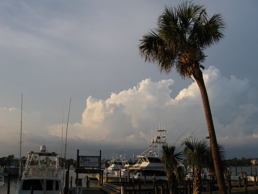
Nice Beach Trip
* Just getting back into the swing of things after vacationing along the Alabama Gulf Coast last week. For those who are curious, the area has undergone a remarkable recovery since Hurricane Ivan struck in September 2004...