Demopolis Tornado Rated an F1
0930 PM TORNADO 3 SW DEMOPOLIS 32.47N 87.87W
11/30/2006 F1 MARENGO AL NWS STORM SURVEY
PRELIMINARY PATH LENGTH 1.2 MILES AND 150 YARDS WIDE. THE
TORNADO STARTED NEAR US HIGHWAY 80 AND MARIA AVENUE.
SEVERAL LARGE TREES WERE BLOWN OVER ONTO HOMES PRODUCING
SIGNIFICANT DAMAGE. SEVERAL MORE LARGE TREES WERE KNOCKED
OVER AND DESTROYED A FEW MOBILE HOMES. ONE APARTMENT
COMPLEX RECEIVED SIGNIFICANT ROOF DAMAGE. A FEW MOBILE
HOMES WERE ROLLED OVER.
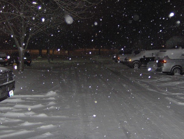
Snow Pic and Odds/Ends
NOTE: You can click on this image for a larger version.
* Here's a snow shot from our old friend Renny Vandewege up in Kansas City, MO. Renny served as weekend meteorologist here, doing a fantastic job, and is now a Weather Producer at KCTV in Kansas City, MO. I should probably note that Renny absolutely nailed this storm system; his forecasting skills are outstanding.
Renny is returning to Mississippi soon to serve as Director of the Broadcast Meteorology Program at Mississippi State. Talk about a fast riser! It's wonderful to see great things happen to great people who have worked hard like Renny.
* RADAR ISSUE STRIKES AGAIN: The lack of Doppler Radar here is going to cost someone their life one day. Due in large part to no good radar data on the storm in question, there was no tornado warning (or any warning) in place before the possible tornado struck the city of Demopolis. Damage was significant in the city, and it's nothing short of miraculous that no one was badly injured or killed. Still, our thoughts are with those who lost their belongings.
* Live truck arrives - WTOK has received our satellite/microwave truck. This will allow us to do live broadcasts from almost anywhere in our area...Pretty cool stuff!
TV Update Coming
* About to go on WTOK and Fox Meridian with an update...Standby...No injuries...EMS asking people to stop going to the hospital for information...
Demopolis Damage Reports
* We are receiving reports of a possible tornado in the city of Demopolis....The reports now center around damage to the Villas Apartment complex and near the hospital...These reports are early, so we are working to verify exactly what's happened tonight.
* There was no tornado warning for this storm, and the radar presentation on this storm while over Marengo County was not terribly impressive...Expect the unexpected.
Wild and Wooly Weather
* The tornado warning for Hale County has been cancelled...Hale County Sheriff's Dept. has reported trees down in Hale County as this storm passed through.
* This storm was a low-topped cell in a high-shear environment. These storms are notorious for dropping unexpected tornadoes on days that just don't seem that favorable for severe weather. This could be an example of that it seems.
* Much colder weather is on the way...Temperatures behind the front in western MS are in the 40's...Jackson is at 48 while Meridian is a whopping 20 degrees warmer at 68!
Warm Now, But Changes Soon...
* This will be a brief post - I'm at home enjoying some time off with my family (and trying to recover from this no-fun cold I've had of late)...
* Storms are likely later this week - in the Wed/Thu window. The most likely time for storms is Thursday. There could be a few strong storms, but I have doubts about any significant threat of severe weather. We'll keep you posted.
* COLD AIR: The coldest air we've seen in months will move in later this week. This airmass has been building across western Canada for the last couple of weeks; it was just a matter of time until it broke out and moved south. Highs Friday and Saturday will likely stay in the 40's, with wintry precipitation as far south as northern Mississippi and northern Alabama. At this point, any wintry precip up there should be light, but we'll watch it closely.