Late Saturday Update
* Big thanks to Josh Johnson for dinner tonight at the Shorewood Inn in Neshoba County. A little expensive, but well worth it; an excellent buffet!
* Josh posted earlier today about the rain chances coming up. Not much change in the thinking since then. I sure get the feeling that we will end the holiday weekend on a wet note, so that is not good news to those with outdoor plans. It is good news however, for those that need the rainfall, and I am sure we all could use some. Looks like we are almost 4 inches below normal for May.
* It also looks that there may be a few strong storms involved Monday, and if that is the case we could be talking about lightning and wind dangers. Remember, if you are outside and hear thunder, you are close enough to be struck by lightning! Stay tuned to the Blog and to WTOK and we will try to be more specific on the forecast as we approach Monday.
* I get the idea that the unsettled weather might stick around Tuesday as well, with stray showers still possible on Wednesday. Even later in the week, I think we will see more clouds than sun, with temperatures right around average for late May/early June.
* Officially, the first day of hurricane season is Wednesday. No active weather to talk about in the Atlantic, Gulf, or Carribbean at this time, though sea surface temperatures (SSTs) are extremely warm.. in the upper 80s!
Where's the rain?
* Showers and thunderstorms have been slow to develop today. But, we'll take as much dry weather as we can get. However, it will soon come to an end...
* There's a surface boundary located roughly along the Highway 80 corridor. We expect showers and thunderstorms to continue to develop along that boundary as we go through the late afternoon into the early evening.
* By later tonight, a piece of energy in the upper atmosphere will rotate in from Louisiana. This will cause rain coverage and intensity to increase, starting in western Mississippi and moving in our direction. The heaviest rain will likely be along and south of Highway 80, in places like Bay Springs, Paulding, Heidelberg, Quitman, Waynesboro, Butler, and Demopolis. Rainfall amounts tonight could exceed one-half inch in the heavier downpours.
* This boundary will push back northward as we go through Sunday and into Monday, bringing more rain with it. Both days will feature dry periods, but we do expect more rain than dry. By the time the rain winds down late Monday/early Tuesday, some places could see over two inches of rain. The best chance of this will be along the Highway 84 corridor.
* BIG thanks to Wade Phillips for lunch at his cookout today. Wade was entertaining his wife's family from Alabama, and it was very nice to meet them and enjoy some good food and great company. It didn't hurt that the Yankees were getting beat badly by the Red Sox. I'm a Braves fan, but I also enjoy rooting for anyone who is playing the Yankees.
It's INTERN time!
* Our summer interns start today. Each afternoon, we'll have an intern from the meteorology program up at Mississippi State. Today, Neal McCarty, a junior from Summit, Mississippi (just north of McComb) visited with us. Neal and I jetted up to Philadelphia for a GREAT meal at Firehouse BBQ after the 6:00 news (a BIG thanks to our friends up there who were letting folks in the door a few minutes after closing time)!
You'll be hearing from the interns next week in this space, once everyone gets in and gets a taste of how we run our weather operation here.
* Looks wet and stormy for the weekend, especially Monday. We could see a shower or two Friday night, but most of the rain will hold off until Saturday. Right now, we expect two "main" periods of rain: one on Saturday morning into early afternoon and another period of rain Monday. That's not to say it won't rain at other times, it almost certainly will. But, this is a very active weekend, and I'll try to be as specific as possible to help people with planning their weekend activities. Again, your best bet is to continue to check back here and at
WTOK Weather for our latest thinking!
Wet by the Weekend...
* It is looking more and more like we will see a decent rainfall this weekend. First, let me say that I do not expect a complete washout. There will be a few dry periods thrown in the mix this weekend as well. But, rain will definitely be a big part of the forecast for parts of the weekend. I'll break it down into a timeline:
Friday: A nice day for the most part. Clouds increase late in the day, and there is an outside chance of a shower or thunderstorm late Friday afternoon. Most places will stay dry Friday.
Saturday: Moisture increases along a front riding through the state. Showers and thunderstorms develop over central Mississippi by Saturday afternoon and evening. Some storms could be strong, and there could be some heavy rain involved as well. We don't expect a widespread severe weather event on Saturday.
Sunday: Perhaps a break in the rain. The front will lift back to the north, with more showers along the Gulf coast. We MAY luck out and be "between" areas of rain for much of Sunday.
Monday: An area of low pressure forms and moves along the front. Showers and thunderstorms are likely, and some of those storms could be severe. Heavy rain is a distinct possibility. Sure looks wet and stormy for Memorial Day. But, like we've been talking about, it sure will help out our rainfall deficit for May.
* The GFS model is calling for dry air to move in by late Tuesday and Wednesday. So, the forecast for those days will reflect smaller rain chances and warmer temperatures.
Rain on the Way
* It is looking more like we will see a rainy period or two during the Memorial Day Weekend. I know that's not what most people want to hear, but we really could use the rain. We still have a 3" rainfall deficit for the month of May.
The weather pattern for the next 4-7 days will be rather unsettled. A front will approach by the weekend, bringing showers and thunderstorms with it. The best chance of rain will come on Saturday. We should have a dry period sometime around the Saturday night/Sunday morning time frame. Then, more rain is possible late Sunday and into Monday. Keep in mind that this is a very rough estimate and will change between now and the weekend. The best course of action is to check back here and at the
WTOK Weather page for our latest thinking!
* FAVORITES: As we get into summertime, I'm going to start a new feature each Wednesday afternoon: a list of favorites of the moment. Just a light look at what I'm enjoying at the moment. Leave a comment with your favorites of the week and I'll publish them on the blog.
Favorite song of the moment: Heartbreaker, Led Zeppelin
Favorite food of the moment: Brick Pit BBQ in Mobile, Alabama -- great stuff!
Favorite vacation spot of the moment: Longboat Key, Florida -- near Sarasota
* Hurricane Awareness Week in Mississippi kicks off next week. The National Hurricane Awareness Week was last week. During the next week, I'll post a lot of GREAT information about how you can be prepared for what's shaping up to be an active tropical season!
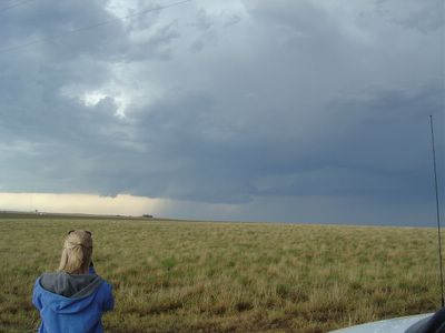
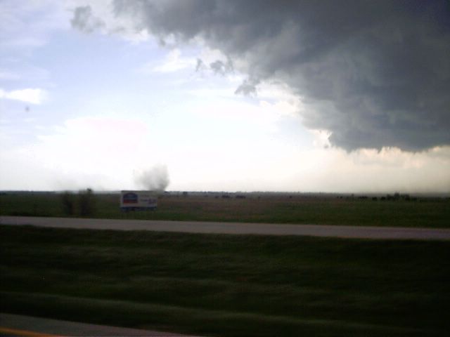
MSU Storm Chase 2005 -- Flat terrain and powerful thunderstorms: a real-life meteorology laboratory! Picture courtesy of Dr. Mike Brown.

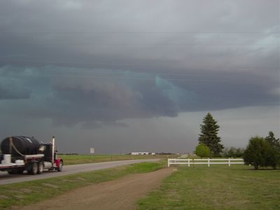
MSU Storm Chase 2005 -- Great view of this storm. Image courtesy of Dr. Mike Brown.

MSU Storm Chase 2005 -- Beautiful structure on this storm! Picture courtesy of Alex Wallace.
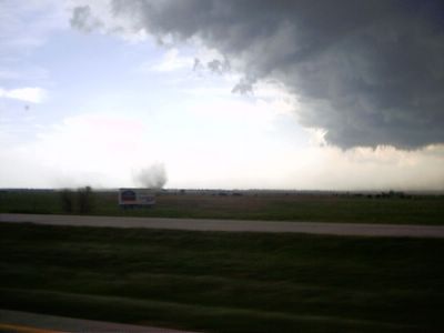
MSU Storm Chase 2005 -- an F0 tornado! Picture courtesy of Alex Wallace.
Storms for Some...Dry for Others...
* A few storms ongoing across parts of central Mississippi - severe thunderstorm warnings have been issued for Scott, Smith, Newton, and Jasper counties....Most of the activity is now in northern Jasper County, stretching southeast into Wayne County...The warnings will expire momentarily...The prime threat with these storms will be frequent lightning and large hail.
* Watching it closely...
Sunday Update
* Looks like lower 90s are possible for Monday! We didn't quite get there today because of some cloud cover in the area.
* Still might expect a few strong to severe storms on Monday. The SPC has all of our area under a 'slight' risk of severe weather. The biggest threat from any storms that form will be damaging winds and dangerous lightning. Hail and heavy rain will be secondary threats. At this time, it doesn't look like tornadoes will be a major concern as the shear profiles aren't very supportive for that to occur. Regardless, Josh will be monitoring the situation tomorrow and break in to programming should it be necessary.
* Looks like a few nice days of weather next week after the storms move through. At this point, weather for the end of the week looks unsettled with more clouds than sun and the chance of a few showers or storms around here Thursday-Saturday as a cold front stalls out around here.
* Enjoy the week, and I'll be back next weekend!
Weekend Wrapup
* Greetings from Mobile, Alabama! I'm here visiting some friends of mine...Tonight was STAR WARS and RIBS night. We watched Return of the Jedi, the sixth installment of the series.
I was in the crowd at Bonita Lakes Mall Wednesday night/Thursday morning for the midnight opening of Episode III: Revenge of the Sith. I REALLY enjoyed it! If you are a Star Wars fan, it truly is a must see!
* Saturday was the final day of Hurricane Awareness Week. The official beginning of hurricane season in the Atlantic Ocean and Gulf of Mexico is on June 1. The action USUALLY gets going by late July, and August and September are usually our two busiest months. The National Hurricane Center put together a website with tons of great information. Check it out:
http://www.nhc.noaa.gov/HAW2/english/intro.shtml* Watching for the possibility of severe weather Monday. The Storm Prediction Center has outlined our area under a "Slight Risk" of severe weather - that's their way of saying they expect some severe weather, but not a widespread episode. We agree with their thinking. The main threats will be large hail and damaging winds.
Here's the Day 3 Outlook from the Storm Prediction Center:
SPC Day 3 Outlook* The rest of the weekend looks fantastic, albeit hot. Temperatures tomorrow will probably end up in the 90's! Enjoy the pleasant weather.