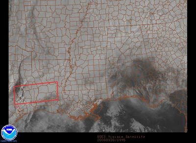
This composite from the SPC shows the visible satellite imagery and any severe weather watches. There is a tornado watch out in SE TX/W LA, but our focus is on the cloud cover. Any breaks in the clouds would result in higher instability - when the sun heats the surface of the Earth, that warms the air near the ground. Warming the lowest levels of the atmosphere is one way to create higher instability. The good news is that we don't see many breaks at all around here this morning. We'll be monitoring the satellite imagery closely today!


0 Comments:
Post a Comment
<< Home