SVR T-Storm Warnings

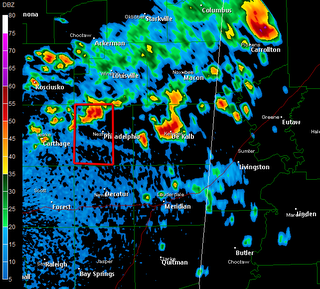
* NOTE: You can click on the above image for a larger version. The red boxes indicate Severe T-Storm Warnings as of the time the image was saved (roughly 2:50 PM)...
* A few of those typical afternoon thunderstorms have strengthened to the point of becoming severe. This, by definition, means that the National Weather Service believes these storms have the potential to produce 3/4" diameter hail and/or 58 mph winds.
http://kamala.cod.edu/offs/KJAN/0608211943.wuus54.html
* This storm will pass just west of Philadelphia, and will likely impact the Pearl River Resort...

0 Comments:
Post a Comment
<< Home