9:15 PM Update
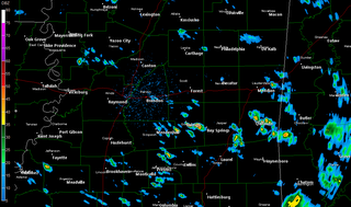
* A few elevated showers and thunderstorms continue to develop across parts of central MS...These are not severe and will almost assuredly stay below severe limits through the next couple of hours.* We still expect the worst of the weather from roughly 4 am Wednesday morning until early Wednesday afternoon...Tornadoes, damaging winds, and large hail are all threats of which we must be aware.
* Here's a radar snapshot - you may click on this image for a larger version:


0 Comments:
Post a Comment
<< Home