Severe Weather Across the Midwest
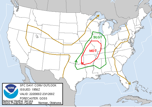
Numerous tornado warnings have been issued this afternoon with discrete cells that are forming ahead of the approaching cold front. Below I have taken a radar image just southwest of St. Louis, Missouri. You will notice that these cells are forming a hook-like feature along the tail-end of the storm. This is indicative of very strong rotation within the storm and where a tornado is likely to form. According to the storm reports on the SPC website, a tornado was confirmed along Interstate 44.
posted by Lauren Raymer @ 3:24 PM
![]()
![]()

0 Comments:
Post a Comment
<< Home