Radar Update
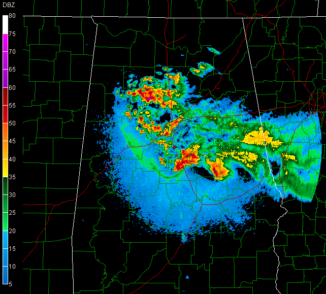
* A few notes about the image...Check out the outflow boundary -- it's the thin green line ahead of the thunderstorms....curving from roughly Clanton, Alabama back through Tuscaloosa County. That boundary will be a focus for thunderstorm development tomorrow...
posted by WTOK Weather Staff @ 9:29 PM
![]()
![]()

0 Comments:
Post a Comment
<< Home