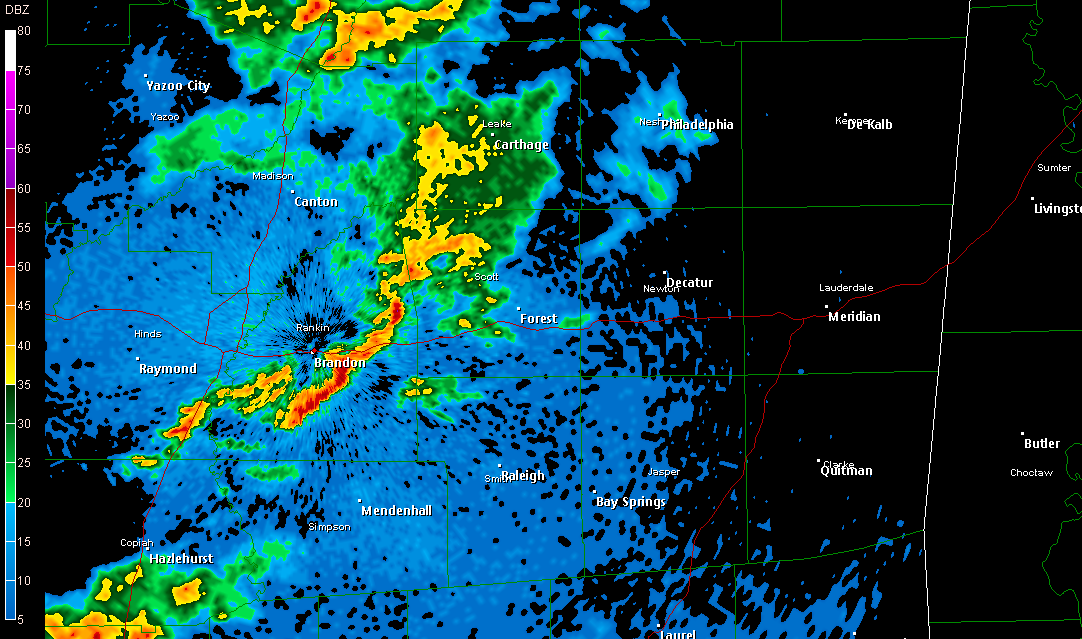
10:00 PM Radar Update
* NOTE: You may click the above image for a larger version.
* A few thunderstorms have developed back to our west, near Jackson. These storms are pushing towards the ESE, and will sweep through parts of Scott, Smith, Newton, and Jasper counties over the next couple of hours. Eventually, these could affect Clarke County, before pushing on into west Alabama. These storms will not be severe, but we cannot rule out some small hail in some of the stronger cells.
posted by WTOK Weather Staff @ 9:59 PM
![]()
![]()

0 Comments:
Post a Comment
<< Home